


Real Estate
A navigable 3D walkthrough of the property, available online so a buyer can see the inside before scheduling a visit — wherever they are.
View solution →We turn your physical space into a navigable 3D experience: a digital representation you can visit, consult and share from any browser. A practical way to show, document and keep a space accessible without relying on an in-person visit.
This is one of our own models. Walk through it right here: move between the areas, look around, and see the space the way a visitor would.
Private Residence in Puerto Viejo
From a capture session coordinated on site, we generate an interactive 3D representation of the space. The result can be toured virtually, exploring its different areas from a browser, and it keeps a digital reference of the place for later use.
That representation works as a digital twin of the space: a navigable digital version that can be consulted and shared whenever it is needed. It does not replace a visit; it stops the visit from being the only way to know the place.
You receive
A navigable virtual tour of the space
What it is for
Present the space remotely, without coordinating a visit
You receive
A link you can share with clients, collaborators or suppliers
What it is for
Let several people see the place without travelling or meeting on site
You receive
The option to embed the tour in your own website
What it is for
Make the space part of your commercial and promotional work
You receive
A visual and spatial reference of the place
What it is for
Document the condition of the space and support coordination between teams
You receive
Access to additional deliverables derived from the same capture
What it is for
Get more than one deliverable out of a single capture, according to the agreed scope.
Additional deliverables are defined according to the contracted scope.
A single capture can yield more than one deliverable. These are the capabilities and products we can derive from it; which ones apply to your project is defined in the proposal.
| ADD-ON | WHAT IT IS | FOR WHOM | CONDITION |
|---|---|---|---|
| Mattertags | WHAT IT IS · Information points inside the tour, with notes, links or content at specific locations. | FOR WHOM · Anyone who needs to explain what is in the space. | CONDITION · Depending on scope. |
| Website embedding | WHAT IT IS · The tour embedded on your own site. | FOR WHOM · Any project with a website. | CONDITION · When the project requires it. |
| Google Street View | WHAT IT IS · Publishing the tour on Google. | FOR WHOM · Hotels, restaurants, shops, museums and other establishments open to the public. | CONDITION · When the project and platform allow it: requires the establishment’s Google listing. Not published for homes. |
| ADD-ON | WHAT IT IS | FOR WHOM | CONDITION |
|---|---|---|---|
| Schematic floor plan | WHAT IT IS · An illustrative floor plan of the space, with approximate measurements. | FOR WHOM · Anyone who needs to understand the layout. | CONDITION · Produced by Matterport on request. Not an architectural or as-built plan. |
| MatterPak files | WHAT IT IS · Derived files for third-party software: 3D mesh, XYZ point cloud and floor and ceiling images. | FOR WHOM · Design teams working with those formats. | CONDITION · Depending on the hosting plan. Not a BIM model. |
| E57 point cloud | WHAT IT IS · The high-density point cloud of the capture. | FOR WHOM · Design or engineering teams working with this kind of data. | CONDITION · Depending on the hosting plan. Not laser scanning or surveying. |
| Promotional video | WHAT IT IS · Video derived from the model, distinct from a native 360° recording. | FOR WHOM · Communication, social media and presentations. | CONDITION · Depending on scope. |
| Ground-level photography | WHAT IT IS · Photographs complementing the 3D capture. | FOR WHOM · Listings, catalogues and communication. | CONDITION · Depending on scope. |
| CAD file (DWG) | WHAT IT IS · A CAD file produced by Matterport’s team from the capture. | FOR WHOM · Design teams needing a base of existing conditions. | CONDITION · Professional plan or higher; timing depends on Matterport. Not certified drawings. |
| BIM model (Revit, LOD 200) | WHAT IT IS · An LOD 200 BIM model produced by Matterport’s team from the capture. | FOR WHOM · Design and coordination teams. | CONDITION · Professional plan or higher; timing depends on Matterport. Not engineering BIM or certified as-built. |
Measurements are for reference: with the Pro2 camera, room dimensions are usually within 1%. The capture uses structured light, not LiDAR. Not all of these products are included automatically: they are defined according to the scope of the project.
The capture is carried out with Matterport technology, a platform specialised in 3D capture and virtual tours.
Other deliverables — such as floor plans, point clouds or views — can also be derived from that same capture, according to the contracted scope and the available capabilities.
The capabilities available depend on the platform and on the contracted scope.
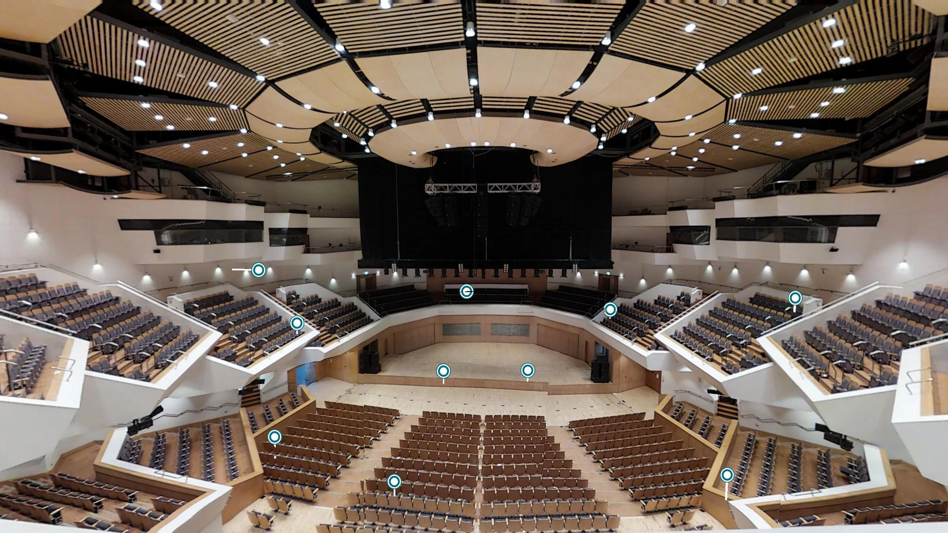 Demonstration model
We understand the space and the objective.
What the place is, what you need to show or document, and for whom.
We define the scope.
Which areas are captured and which deliverables go into the proposal.
We coordinate the capture.
Date, access and site conditions.
We capture on site.
One capture session with the specialised team.
We process and prepare.
The model and the agreed deliverables.
We deliver and publish.
According to the scope defined for the project.
The tour is the same; what changes is what it is used for. These are some of the objectives it solves.
A navigable 3D walkthrough of the property, available online so a buyer can see the inside before scheduling a visit — wherever they are.
View solution →A navigable record of the site's progress at every stage, available for the client, the technical team, and investors to check from wherever they are.
View solution →A navigable walkthrough of the property as it stood on the day of capture, available by link to everyone involved.
View solution →A navigable walkthrough of each unit, ready before it becomes vacant and reusable for as long as it still describes it accurately.
View solution →Show the layout, the atmosphere, and what your space offers in a 3D walkthrough your customers can explore online before coming in.
View solution →A navigable walkthrough that connects rooms, common areas, and surroundings in one piece, so someone choosing where to stay can see it before arriving.
View solution →A navigable walkthrough of the space and what it displays, right where it sits, available online while the show is open and after.
View solution →A navigable walkthrough of the restaurant and its atmosphere, showing the layout that food photography doesn't cover.
View solution →Venues and convention centres shown before a site visit is arranged, and trade shows that stay explorable after teardown, with active hosting.
View solution →These are examples of application, not a closed list.
Every project has different characteristics and objectives. Tell us what you need and we will recommend the most suitable scope and deliverables.

Loading the walkthrough…
It may take a few seconds depending on your connection.
COULDN'T LOAD
The walkthrough didn't load
It may be your connection or the model provider. Try again.