

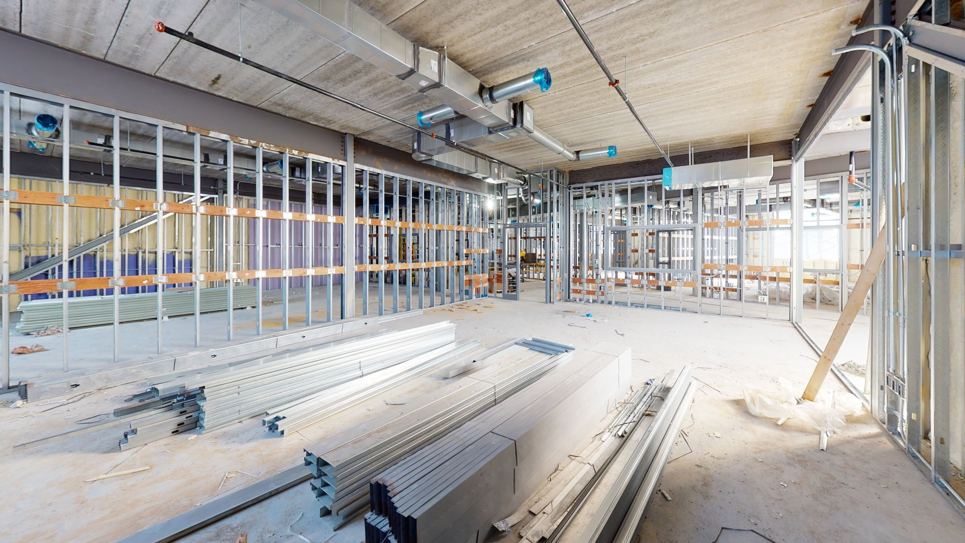
Before finishes close up
while services and reinforcement are still visible.
A 3D capture of the site exactly as it stood on the day of the session, available by link once the project has moved on and those areas are closed off.
Greenvale Elementary Main Level
Keep a visual and spatial record of your construction project's progress, captured at different stages and available for review from any browser. A practical way to communicate the state of the site between your field and office teams.
Starting with capture sessions carried out at different points in the project, we produce navigable 3D references of the site at each stage. The service complements your project's existing technical documentation and coordination processes with a visual and spatial reference for each stage captured. It does not replace professional inspections or engineering services.
Captures can be coordinated around relevant milestones or agreed project stages, to maintain successive visual references of the site's progress over time. Frequency is defined according to each project's characteristics and needs, not on a fixed schedule.
RECORDING MOMENTS
The documentation records what is observable on site on the day of the session. Depending on what will need to be checked later, the session is planned at one of these moments.
STARTING CONDITIONS
How the site looked before work began, or before an area was intervened.
STAGES AND MILESTONES
A record at the close of each agreed stage: structure, services, finishes.
PROGRESS BETWEEN DATES
Successive sessions, each with its date, viewable later. The comparison is made by whoever reviews them; it is not automated.
BEFORE AND AFTER A JOB
The condition before and after a repair, a remodel or a specific intervention.
HANDOVER AND CLOSE-OUT
A visual reference of the site’s condition at handover.
It is a visual and spatial reference: not an expert appraisal, a certified inspection, a topographic survey or an engineering measurement.
while services and reinforcement are still visible.
where recording progress across successive sessions makes sense.
owner, technical management, and contractors reviewing the same site from different places.
to leave a record of the state of the site at the moment it is handed over.
where it helps to keep the before and after of the job.
Capture can be carried out using Matterport, a platform specialized in 3D capture and spatial documentation.
When the capture happens changes what gets recorded. Write to us with the details of the project and we'll propose which areas to capture and when.

Loading the walkthrough…
It may take a few seconds depending on your connection.
COULDN'T LOAD
The walkthrough didn't load
It may be your connection or the model provider. Try again.